|
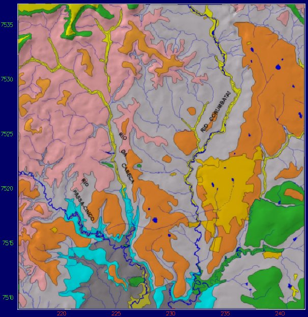
view from top
(not exaggerated) |
|
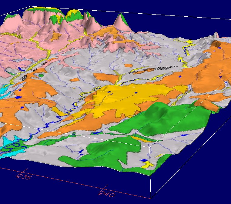
view from southeast |
|
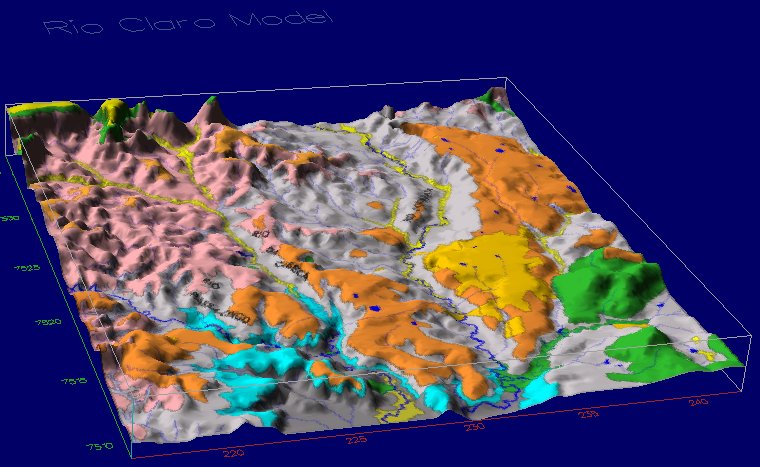
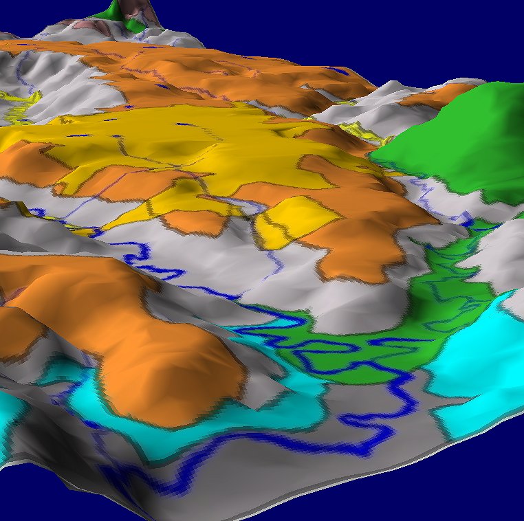
perspective view |
|
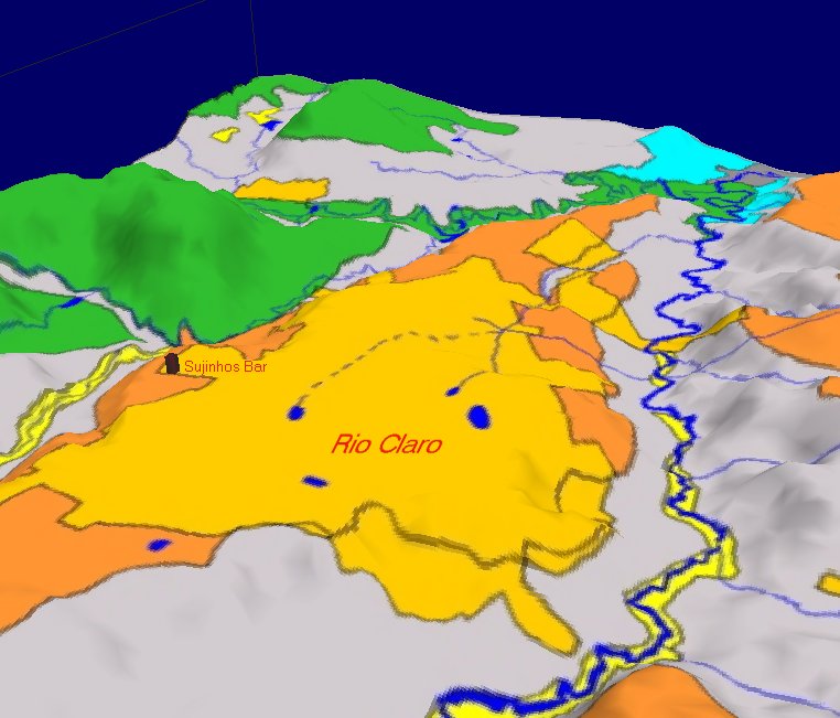
detail shows location of Sujinhos Bar vis a vis the UNESP campus |

|
texture image with 512 pixel size |
|
texture image with 1024 pixel size |
Howto setup textured models in Geo3View - Part I: Pre-processing and commands |
|
| Commands | Steps |
| cd /disco1/g3/demo | goto the Geo3View demo tree |
| mkdir example1 | make a demo directory
(named here example1) |
| cd example1 | change into new directory |
| cp ~hans/surfer/topo.grd . | Copy the surfer raster file named topo.grd from hans home directory (subdir surfer) to the current demo directory |
| ras2rdis topo.grd | Start ras2rdis program to triangulate the
surfer ASCII grid file name topo.grd.
The result is named topo.dis and is readable for Geo3View (MovieBYU-format) |
| texture image.tga | generate a texture map from a file (in this
example image.tga) The result is named
image.rgb (no scaling is applied). |
| mv image.rgb image1024.rgb | rename the file according to its resolution. |
| texture image1024.tga 512 | Its useful to generate another texture with a lower level of detail. Here we chose a resolution of 512 pixel. |
| mv image1024.rgb image512.rgb | again, rename the file according to its resolution. |
| g3 | start Geo3View to test the model |
| read mesh topo.dis | display the file topo.dis within Geo3View |
| open texture image512.rgb topo | load the texture named image512.rgb onto the part named topo. If you do not know the name of your parts type pl (list of parts) |
| pas 2
(or Geo3Rgb-shading menu) |
select the "texture" as shading mode
(option in Geo3Rgb tool) |
Howto setup textured models in Geo3View - Part II: Optional Commands | |
| ih | OPTIONAL: list all possible texture
commands you can use within Geo3View
(most are for experts only) |
| ip | OPTIONAL: print information about the actual texture environment (see OpenGl man pages for detailed explanation) |
| Why you should load a texture with low resolution first? Its a strategy to select a good point of view with appropriate lightening etc. under conditions of fast screen refresh rates. There are usually a lot of scenes to display before you find the best point of view by adjusting the camera opening angle (ca), the distance (cd) and the lights. After this phase you are able to delete the low resolution texture (used for fast orientation) and load the texture with a higher level of detail. | |
| pp * | protect all parts and textures |
| pf topo | free part named topo |
| idel | delete textures from the model.
Affected are only textures of visible and free parts (in this example the part topo). |
| open texture image1024.rgb topo | load the texture named image1024.rgb onto
the part named topo (the lower
resolution texture has been deleted before). |
Howto setup models in Geo3View - Part III: Model specific menus | |
|
When starting Geo3View a file called commands.cfg will
be searched in the demo directory. If it is present, the lines
are interpreted by the Geo3Menu program. Menus are
built according to the datafile. Examine the file
commands.cfg which contains additional information to
format properly. Start the demo to see what will happen.
Frequently little Geo3View-scripts are called, e.g. the script tex2040 in case of selecting the line Geology 2040x2186 pixel from the menu Textures. |
|
|
Example menu file: /disco1/g3/demo/rclaro/commands.cfg
M "Textures" 4
C "Geology 1020x1093 pixel" "<tex1020" "(on)" 0 C "Geology 2040x2186 pixel" "<tex2040" "(off)" 0 C "Fractures 2048x2048 pixel" "<fractures" "(off)" 0 C "Rivers 1307x1394 pixel" "<rivers" "(off)" 0 C "Hide texture" "idel" "(off)" 0
C "NorthWest " "<northwest" "(off)" 0 C "South " "<south" "(off)" 0 C "Passa-Cinco " "<passa-cinco" "(off)" 0 C "Cabeca " "<cabeca" "(off)" 0 C "Corumbatai" "<corumbatai" "(off)" 0
C "Zoom out" "cd 40" "(off)" 0
C "Exit Geo3view" "!gclean" " " 0 |
Highlighted
example to build a
menu named:
Textures with the submenu point: Geology 2040x2186 pixel calling (<) the script tex2040 upon user request |
| The Geo3View-script: tex2040:
fb pf * idel open texture big.rgb rclaro_grd_dec50kt pas 2 fe |
frame begin free all parts delete all textures load a new texture shading mode: texture frame end |